click on the image to zoom click on the image to zoom
click on the image to zoom
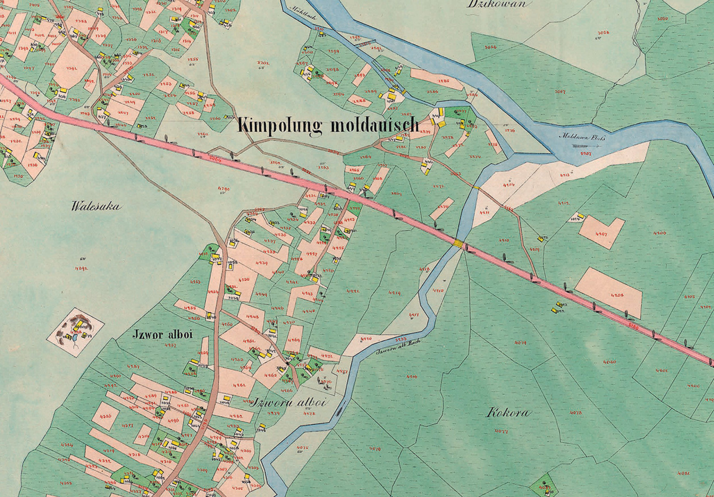
Planșă cadastrală - Partea de est a Câmpulungului Moldovenesc, la 1854
Planșă cadastrală - Partea de est a Câmpulungului Moldovenesc, la 1854 (extrasă din "Der Franziszeische Kataster im Kronland Bukowina/ Czernowitzer Kreis (1817–1865)").
Se pot observa, cu o precizie impresionantă (cel puțin pentru acea vreme) parcelele bine delimitate, Izvorul Alb (denumit la acea vreme Izvorul Alboi) și râul Moldova.
Explore the archive
Discover other elements in the media library:
Tourists on Runc
1933, Câmpulung Moldovenesc
Tourists on Runc, with a local guide
Strada mare, în 1905
1915, Câmpulung Moldovenesc
Centrul, către Biserica Sf. Nicolae și Școala Bogdan Vodă, în 1905.
Ethnic groups from Bucovina - Roma
Ethnic groups from Bucovina - Roma
Lemnari la lucru
1960, Stulpicani
Muncitori la Fabrica de cherestea Frasin
Girls' school
1900, Câmpulung Moldovenesc
Maedchenvolksschule. The school for girls in the city center.
The museum, over time
Câmpulung Moldovenesc
The museum, over time