click on the image to zoom click on the image to zoom

click on the image to zoom
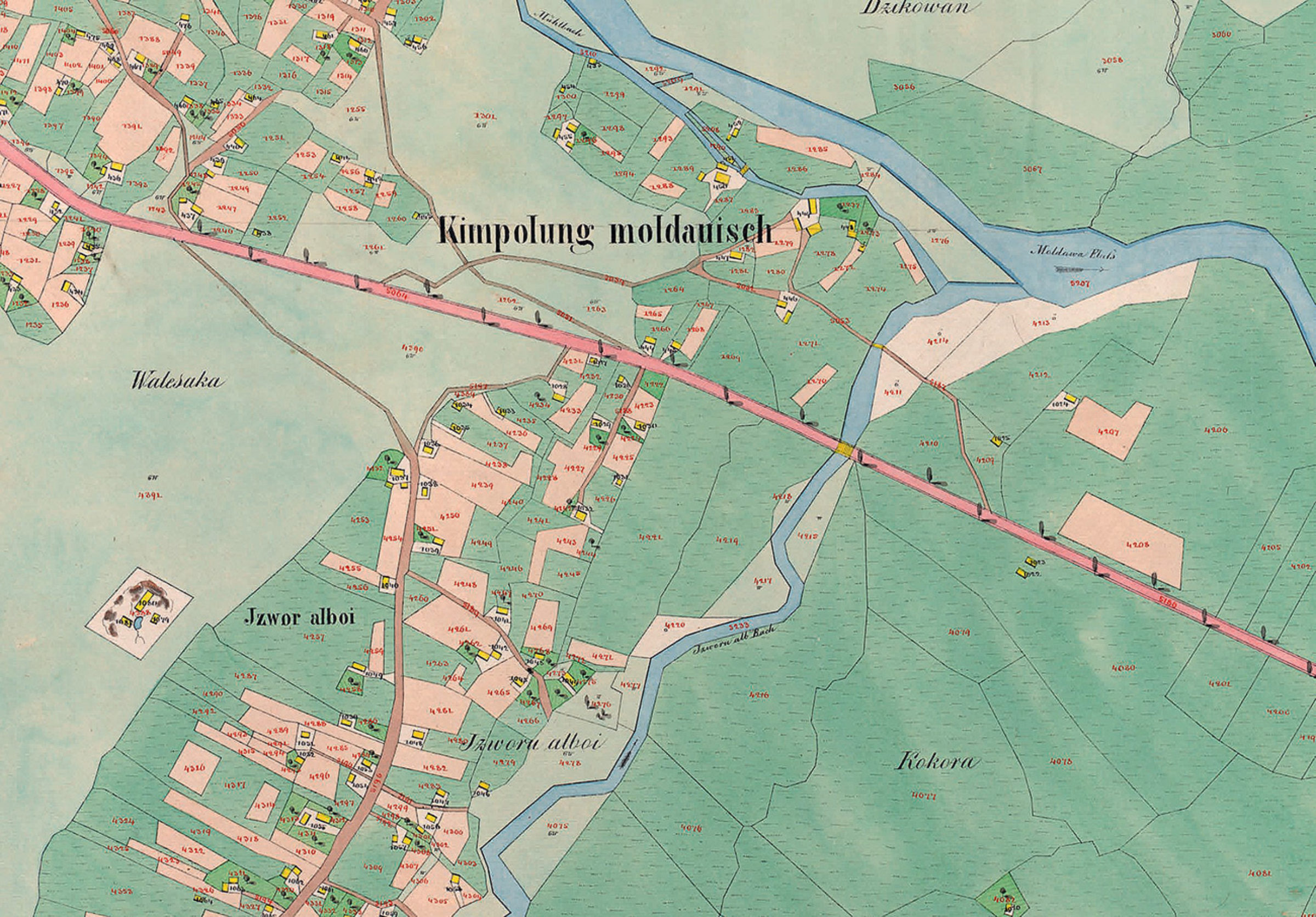
Planșă cadastrală - Partea de est a Câmpulungului Moldovenesc, la 1854
Planșă cadastrală - Partea de est a Câmpulungului Moldovenesc, la 1854 (extrasă din "Der Franziszeische Kataster im Kronland Bukowina/ Czernowitzer Kreis (1817–1865)").
Se pot observa, cu o precizie impresionantă (cel puțin pentru acea vreme) parcelele bine delimitate, Izvorul Alb (denumit la acea vreme Izvorul Alboi) și râul Moldova.
Explore the archive
Discover other elements in the media library:
The museum, over time
Câmpulung Moldovenesc
The museum, over time
The statue "Dragoș-Vodă and the bison", a few months after its installation
1978, Câmpulung Moldovenesc
The statue "Dragoș-Vodă and the bison", a few months after its install [...]
Boguș's mill
Câmpulung Moldovenesc
Boguș's Mill - on Gârla Morii (Hotel Cosmos area) from Câmpulung Moldo [...]
Voroneț Monastery, in 1938
1938, Gura Humorului
Voroneț Monastery, in 1938
The hut on Magura
1975, Câmpulung Moldovenesc
The hut on Magura
Traditional house
1968, Moldova-Sulița
Traditional house from Moldova-Sulita


