click on the image to zoom click on the image to zoom
click on the image to zoom
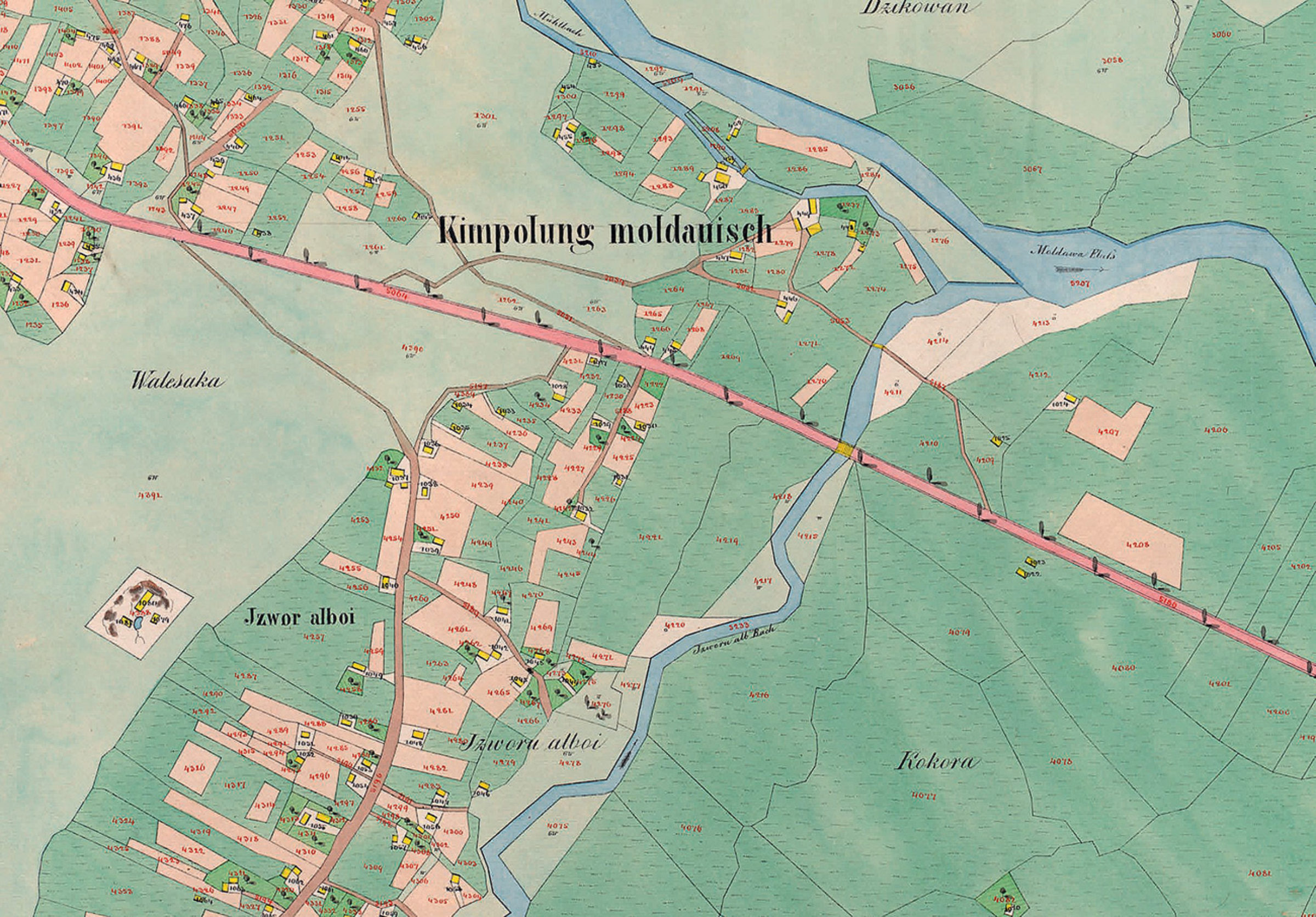
Planșă cadastrală - Partea de est a Câmpulungului Moldovenesc, la 1854
Planșă cadastrală - Partea de est a Câmpulungului Moldovenesc, la 1854 (extrasă din "Der Franziszeische Kataster im Kronland Bukowina/ Czernowitzer Kreis (1817–1865)").
Se pot observa, cu o precizie impresionantă (cel puțin pentru acea vreme) parcelele bine delimitate, Izvorul Alb (denumit la acea vreme Izvorul Alboi) și râul Moldova.
Explore the archive
Discover other elements in the media library:
Strada principală (Herrengasse)
1904, Câmpulung Moldovenesc
Strada principală / Herrengasse, mai jos de Școala de Arte și Meserii.
Malanca - New Year folk custom
Câmpulung Moldovenesc
Malanca - New Year folk custom
Castelul din Poiana Ițcani
1930, Valea Putnei
Intrarea principală în Castel
Dulgheri la Sadova
1970, Sadova
Dulgheri la Sadova
Malanca - New Year folk custom
Câmpulung Moldovenesc
Malanca - New Year folk custom
Moara lui Boguș
1918, Câmpulung Moldovenesc
Moara lui Leon Boguș (situată pe Gârla Morii în zona complexului Cosmo [...]