click on the image to zoom click on the image to zoom

click on the image to zoom
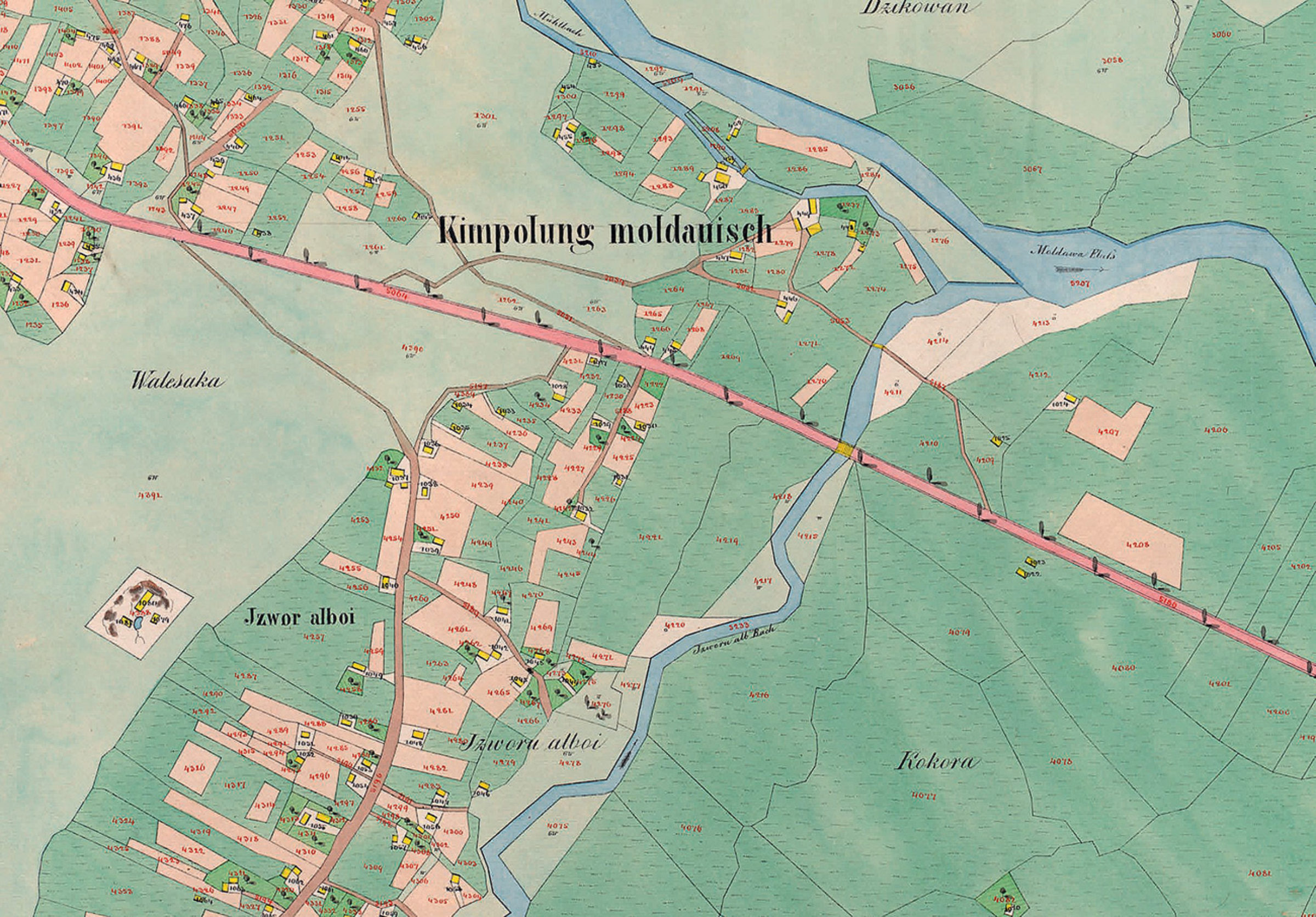
Planșă cadastrală - Partea de est a Câmpulungului Moldovenesc, la 1854
Planșă cadastrală - Partea de est a Câmpulungului Moldovenesc, la 1854 (extrasă din "Der Franziszeische Kataster im Kronland Bukowina/ Czernowitzer Kreis (1817–1865)").
Se pot observa, cu o precizie impresionantă (cel puțin pentru acea vreme) parcelele bine delimitate, Izvorul Alb (denumit la acea vreme Izvorul Alboi) și râul Moldova.
Explore the archive
Discover other elements in the media library:
Malanca - New Year folk custom
Câmpulung Moldovenesc
Malanca - New Year folk custom
Berg Heil! - Trăiască muntele!
1913, Câmpulung Moldovenesc
Carte poștală aniversară: jubileul de 25 ani (1888-1913) al secțiunii [...]
Launch of the game of chess
1982, Câmpulung Moldovenesc
Launch of the chess game with giant pieces, sculpted by prof. Ion Maft [...]
Dowry box
Câmpulung Moldovenesc
Dowry box
"Bogdan Voda" School
1958, Câmpulung Moldovenesc
"Bogdan Voda" School
Traditional attire
Câmpulung Moldovenesc
Traditional attire


