click on the image to zoom click on the image to zoom

click on the image to zoom
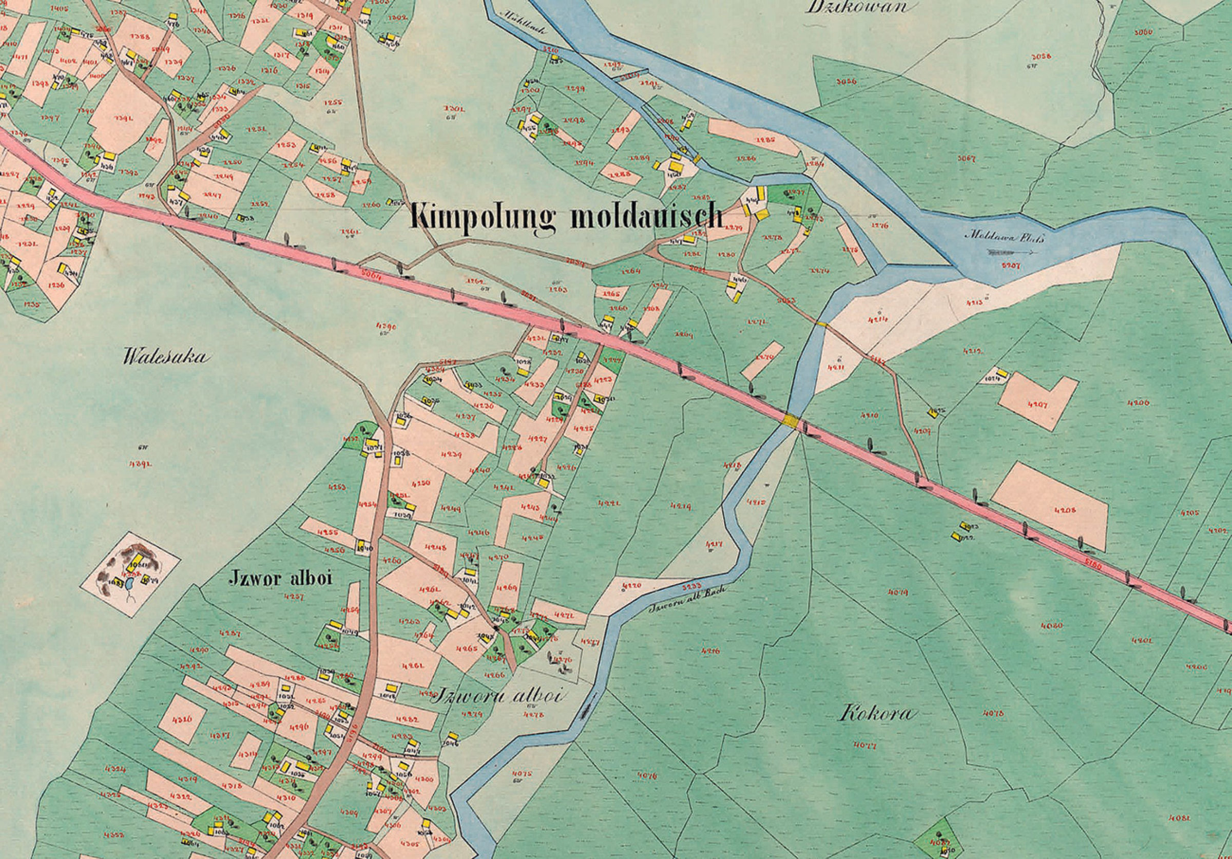
Planșă cadastrală - Partea de est a Câmpulungului Moldovenesc, la 1854
Planșă cadastrală - Partea de est a Câmpulungului Moldovenesc, la 1854 (extrasă din "Der Franziszeische Kataster im Kronland Bukowina/ Czernowitzer Kreis (1817–1865)").
Se pot observa, cu o precizie impresionantă (cel puțin pentru acea vreme) parcelele bine delimitate, Izvorul Alb (denumit la acea vreme Izvorul Alboi) și râul Moldova.
Explore the archive
Discover other elements in the media library:
Peasant installations
1968, Chiril
Saw and mill in Chiril-Crucea
Horsewoman
1970, Colacu
Rider on horseback
Cabana Rarău, iarna.
1942, Câmpulung Moldovenesc
"Spre culmi". Drumul către cabana Rarău.
Metropolitan Silvestru Morariu
Archbishop and Metropolitan Silvestru Morariu-Andrievici
The weapons corner in the hall of traditional occupations
1965, Câmpulung Moldovenesc
The corner of arms in the hall of traditional occupations of the old M [...]
Deia stream
Câmpulung Moldovenesc
Deia stream


